
Jessee Cemetery
Champaign County, Illinois, USA
About
-
- Cemetery ID:
Members have Contributed
Photos


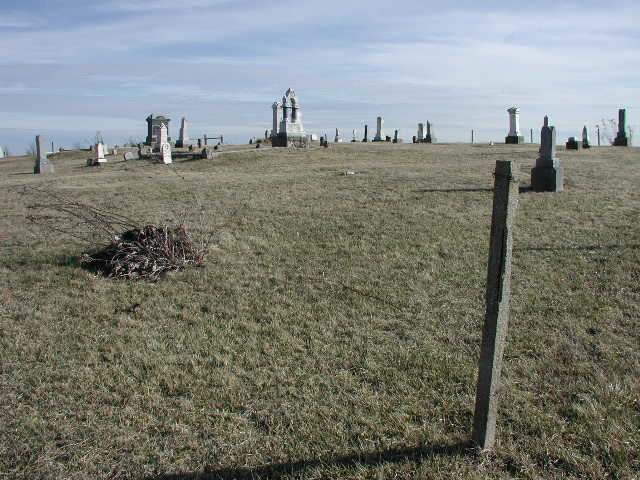
The Jessee Cemetery was at one time surrounded by a wire fence and it is not very well kept. Several stones are broken, some stones are missing, and some plots seem to be unmarked.
It was originally a family and surrounding area cemetery and the earliest burial is said to be Thomas Jessee in 1869. The land was deeded by David H and Elizabeth Jessee to the cemetery trustees committee in 1882.
At some point in time, at least some of the "old" part of the cemetery was vacated. This likely occurred prior to October, 1901, when the intersection to the immediate north of the cemetery was redesigned as a cost saving measure to the county to allow one small iron bridge to serve in the place of two bridges. Although some headstones can still be found along the east side of the N-S access road leading to the turn off for the cemetery there are no headstones in the field between the "new" and "old" parts of the cemetery. Please do not enter that area as it is private property/farm land. A plot map, (see cemetery photo section), and the D.A.R. headstone reading, availalble at the Champaign County Historical Archives, are currently the only known records for the cemetery despite public inquires for information. Although once abandoned, it has recently been, at least, minimally maintained. 1/2025
The Jessee Cemetery was at one time surrounded by a wire fence and it is not very well kept. Several stones are broken, some stones are missing, and some plots seem to be unmarked.
It was originally a family and surrounding area cemetery and the earliest burial is said to be Thomas Jessee in 1869. The land was deeded by David H and Elizabeth Jessee to the cemetery trustees committee in 1882.
At some point in time, at least some of the "old" part of the cemetery was vacated. This likely occurred prior to October, 1901, when the intersection to the immediate north of the cemetery was redesigned as a cost saving measure to the county to allow one small iron bridge to serve in the place of two bridges. Although some headstones can still be found along the east side of the N-S access road leading to the turn off for the cemetery there are no headstones in the field between the "new" and "old" parts of the cemetery. Please do not enter that area as it is private property/farm land. A plot map, (see cemetery photo section), and the D.A.R. headstone reading, availalble at the Champaign County Historical Archives, are currently the only known records for the cemetery despite public inquires for information. Although once abandoned, it has recently been, at least, minimally maintained. 1/2025
Nearby cemeteries


- Added: 1 Jan 2000
- Find a Grave Cemetery ID: 106352

Cemetery Photos
This is a carousel with slides. Use Next and Previous buttons to navigate, or jump to a slide with the slide dots. Use Escape keyboard button or the Close button to close the carousel.


Success
Uploading...
Waiting...
Failed
This photo was not uploaded because this cemetery already has 20 photos
This photo was not uploaded because you have already uploaded 5 photos to this cemetery
This photo was not uploaded because you have already uploaded 5 photos to this cemetery
Invalid File Type
Birth and death years unknown.
1 photo picked...
2 photos picked...
Uploading 1 Photo
Uploading 2 Photos
1 Photo Uploaded
2 Photos Uploaded
This photo is larger than 20 MB. Please resize to less than 20 MB and try again.
Too many photos have been uploaded
"Unsupported file type"
• ##count## of 0 memorials with GPS displayed. Double click on map to view more.No cemeteries found