
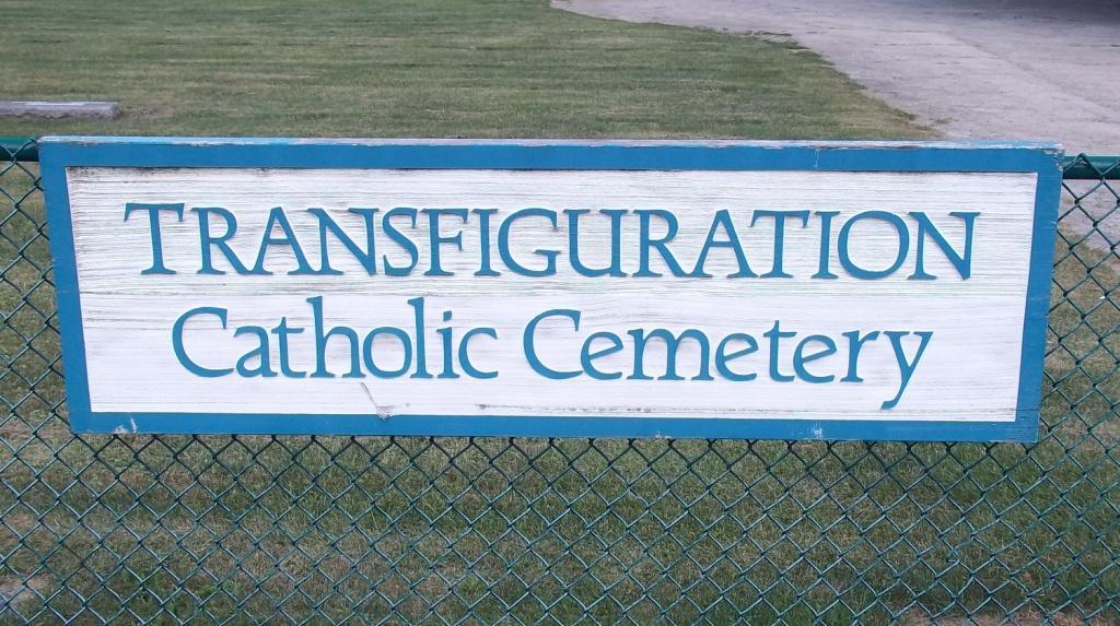
Transfiguration Catholic Cemetery
Also known as Transfiguration Cemetery, St John's Mission Graveyard, Murray Settlement Graveyard
Fremont Township, Lake County, Illinois, USA
About
-
- www.catholiccemeterieschicago.org/Burial/Access
- 847-362-1247
-
Office Address
1920 Buckley Rd
Libertyville, IL 60048
United States - Cemetery ID:
Members have Contributed
Photos


Cemetery office located at Ascension Catholic Cemetery & Mausoleums in Libertyville, IL
Established 1856, the Transfiguration Catholic Cemetery was formerly known as the St. John's Mission graveyard, then Cemetery, from 1841 to as late as 1903. Murray and Davlin families hosted the St John's Mission visiting priest at the Murray Settlement home and buried their dead here after 1841 likely starting with the burial of toddler Elizabeth J Sinnott (1840-1842). Some burials are of whom died in the journey to what was known as Rice's Praire to present day Wauconda rural district and Davlin's Corners part of present day Tower Lakes, IL. Some Davlin and Kirwan family remains likely reburied to here by 1856. As the Murray family settled in 1836, the transition from hosting mass and bible study in their home in 1841 every two weeks became more regular to the dedication of the their allotted land now known as Transfiguration Cemetery with the erection of a log cabin chapel and altar in 1844. Early burials before 1856, numbering upward of 14 burials, then had a dual moniker of Murray Settlement or St John's Mission graveyard spoken depending on Catholic eastern Wauconda or Protestant western Wauconda settlers. The name Wauconda did not yet exist and many preferred to call western Wauconda Bangs Lake rather than Bangs Settlement. At the time, Wauconda was predominantly known as part of a rural voting district of Fort Hill.
The original log cabin chapel front porch is reported to have been where the cemetery entrance back key drive turns at the cemetery crucifix monument. A log cabin school house and gardener shack were set back from the graveyard boundary at the back row of trees where remnants of chain link fence posts are still found embedded in those tree trunks. Once the log cabin was built, the predominant place name became St. John's Mission.
The Transfiguration name came about upon the dedication of the old bell tower church building on Mill & Church Sts on land purchased from settler Justus Bangs built by the Murray, Davlin, McMahon and other families on the Catholic Holy Feast Day of the Transfiguration August 6, 1877. Between 1877 and the congregation established as a parish with a full time priest in 1903, the naming of the church Transfiguration on that day came into use as the name of the mission and the cemetery.
The log cabins of the chapel, school, and gardeners shack had since dismantled and the cemetery expanded upon there, now known as Section 3, as reorganized and surveyed on June 13, 1929 reported as 2.81 acres by Frank Joseph Geraghty now buried in the Saint Mary Catholic Cemetery, Lake Forest, IL. A that time an 8 graves per lot grid had been employed with the following scheme:
Lot Layout
2 rows left to right, which is west to east
Top / North 4, 3, 2, 1
Bottom / South 8, 7, 6, 5
The original graveyard grounds was 1.62 acres where the older plot card lot numberings do not fit precisely in the 1929 survey grid and followed an old lot scheme. The Ascension Cemetery office has the survey map though much work has been done to GPS tag all these memorials into Find a Grave. Many have sunken or no markers to still be located. Some work has raised sunken stones & pursue missing markers. A more modern integrated map post the 1929 survey now used by the cemetery office is posted in the cemetery photos here with markup provided by F G Graver Barry Juras. The markup attempts to convey the old lot scheme as graves numbered 1-96 arranged east to west with the back row 8 designated as Blk 11.
The old bell tower church aforementioned has one of the stain glass windows boarded up with the depiction of the log cabin chapel behind the graveyard. A journal was once kept there on the activities of that log cabin as the congregation outgrew the place when the church was built. The 1929 survey notes the cemetery was opened in 1856 a time when other families may have buried or reburied their dead there. These events depict an impromptu family settlement graveyard transitioned to a designated graveyard, to an organized cemetery with a name change, and a later expanded cemetery.
Cemetery office located at Ascension Catholic Cemetery & Mausoleums in Libertyville, IL
Established 1856, the Transfiguration Catholic Cemetery was formerly known as the St. John's Mission graveyard, then Cemetery, from 1841 to as late as 1903. Murray and Davlin families hosted the St John's Mission visiting priest at the Murray Settlement home and buried their dead here after 1841 likely starting with the burial of toddler Elizabeth J Sinnott (1840-1842). Some burials are of whom died in the journey to what was known as Rice's Praire to present day Wauconda rural district and Davlin's Corners part of present day Tower Lakes, IL. Some Davlin and Kirwan family remains likely reburied to here by 1856. As the Murray family settled in 1836, the transition from hosting mass and bible study in their home in 1841 every two weeks became more regular to the dedication of the their allotted land now known as Transfiguration Cemetery with the erection of a log cabin chapel and altar in 1844. Early burials before 1856, numbering upward of 14 burials, then had a dual moniker of Murray Settlement or St John's Mission graveyard spoken depending on Catholic eastern Wauconda or Protestant western Wauconda settlers. The name Wauconda did not yet exist and many preferred to call western Wauconda Bangs Lake rather than Bangs Settlement. At the time, Wauconda was predominantly known as part of a rural voting district of Fort Hill.
The original log cabin chapel front porch is reported to have been where the cemetery entrance back key drive turns at the cemetery crucifix monument. A log cabin school house and gardener shack were set back from the graveyard boundary at the back row of trees where remnants of chain link fence posts are still found embedded in those tree trunks. Once the log cabin was built, the predominant place name became St. John's Mission.
The Transfiguration name came about upon the dedication of the old bell tower church building on Mill & Church Sts on land purchased from settler Justus Bangs built by the Murray, Davlin, McMahon and other families on the Catholic Holy Feast Day of the Transfiguration August 6, 1877. Between 1877 and the congregation established as a parish with a full time priest in 1903, the naming of the church Transfiguration on that day came into use as the name of the mission and the cemetery.
The log cabins of the chapel, school, and gardeners shack had since dismantled and the cemetery expanded upon there, now known as Section 3, as reorganized and surveyed on June 13, 1929 reported as 2.81 acres by Frank Joseph Geraghty now buried in the Saint Mary Catholic Cemetery, Lake Forest, IL. A that time an 8 graves per lot grid had been employed with the following scheme:
Lot Layout
2 rows left to right, which is west to east
Top / North 4, 3, 2, 1
Bottom / South 8, 7, 6, 5
The original graveyard grounds was 1.62 acres where the older plot card lot numberings do not fit precisely in the 1929 survey grid and followed an old lot scheme. The Ascension Cemetery office has the survey map though much work has been done to GPS tag all these memorials into Find a Grave. Many have sunken or no markers to still be located. Some work has raised sunken stones & pursue missing markers. A more modern integrated map post the 1929 survey now used by the cemetery office is posted in the cemetery photos here with markup provided by F G Graver Barry Juras. The markup attempts to convey the old lot scheme as graves numbered 1-96 arranged east to west with the back row 8 designated as Blk 11.
The old bell tower church aforementioned has one of the stain glass windows boarded up with the depiction of the log cabin chapel behind the graveyard. A journal was once kept there on the activities of that log cabin as the congregation outgrew the place when the church was built. The 1929 survey notes the cemetery was opened in 1856 a time when other families may have buried or reburied their dead there. These events depict an impromptu family settlement graveyard transitioned to a designated graveyard, to an organized cemetery with a name change, and a later expanded cemetery.
Nearby cemeteries


- Added: 1 Jan 2000
- Find a Grave Cemetery ID: 108570

Cemetery Photos
This is a carousel with slides. Use Next and Previous buttons to navigate, or jump to a slide with the slide dots. Use Escape keyboard button or the Close button to close the carousel.


Success
Uploading...
Waiting...
Failed
This photo was not uploaded because this cemetery already has 20 photos
This photo was not uploaded because you have already uploaded 5 photos to this cemetery
This photo was not uploaded because you have already uploaded 5 photos to this cemetery
Invalid File Type
Birth and death years unknown.
1 photo picked...
2 photos picked...
Uploading 1 Photo
Uploading 2 Photos
1 Photo Uploaded
2 Photos Uploaded
This photo is larger than 20 MB. Please resize to less than 20 MB and try again.
Too many photos have been uploaded
"Unsupported file type"
• ##count## of 0 memorials with GPS displayed. Double click on map to view more.No cemeteries found