
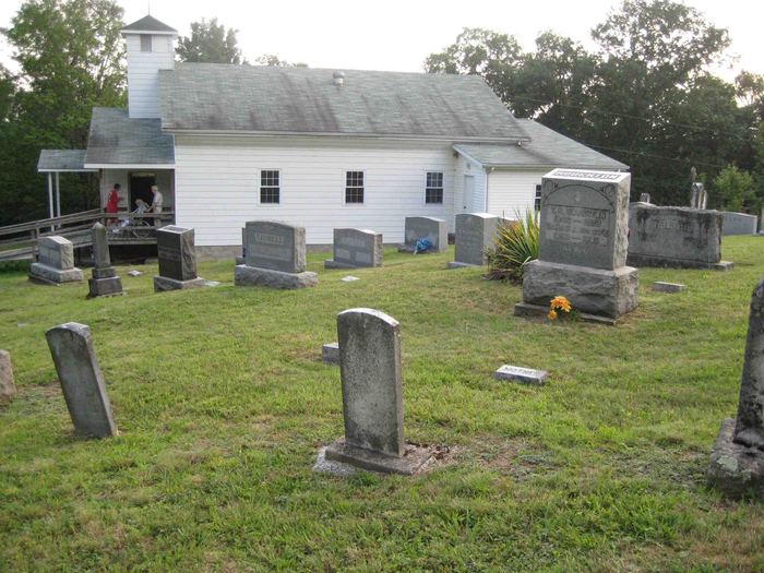
Walnut Grove Church Cemetery
Widen, Clay County, West Virginia, USA
About
-
Get directions Wilson Ridge Road
Widen, West Virginia 26339 United StatesCoordinates: 38.50232, -80.86677 - Cemetery ID:
Members have Contributed
Photos


United Methodist Church
Wilson Ridge Rd
Strange Creek, WV 26339
(in Clay County, near Widen)
Driving Directions:
Take I-79 to Rt 19 going South towards Beckley / Summersville. Go approximately 15 to 20 miles to the Birch River exit. Go to the bottom of the ramp and turn right onto the Dille / Widen Road. Follow the yellow line approximately 10 to 12 miles until you reach a 4-way intersection in the road. At that intersection is a 4 foot tall rock triangle that sits on the left with a sign for Widen, WV. At that point, Wilson Ridge Road turns to the right. Go 2 miles on Wilson Ridge Road and you will see the church sitting up on the right of the road.
United Methodist Church
Wilson Ridge Rd
Strange Creek, WV 26339
(in Clay County, near Widen)
Driving Directions:
Take I-79 to Rt 19 going South towards Beckley / Summersville. Go approximately 15 to 20 miles to the Birch River exit. Go to the bottom of the ramp and turn right onto the Dille / Widen Road. Follow the yellow line approximately 10 to 12 miles until you reach a 4-way intersection in the road. At that intersection is a 4 foot tall rock triangle that sits on the left with a sign for Widen, WV. At that point, Wilson Ridge Road turns to the right. Go 2 miles on Wilson Ridge Road and you will see the church sitting up on the right of the road.
Nearby cemeteries


- Added: 4 Jan 2006
- Find a Grave Cemetery ID: 2162628

Cemetery Photos
This is a carousel with slides. Use Next and Previous buttons to navigate, or jump to a slide with the slide dots. Use Escape keyboard button or the Close button to close the carousel.


Success
Uploading...
Waiting...
Failed
This photo was not uploaded because this cemetery already has 20 photos
This photo was not uploaded because you have already uploaded 5 photos to this cemetery
This photo was not uploaded because you have already uploaded 5 photos to this cemetery
Invalid File Type
Birth and death years unknown.
1 photo picked...
2 photos picked...
Uploading 1 Photo
Uploading 2 Photos
1 Photo Uploaded
2 Photos Uploaded
This photo is larger than 20 MB. Please resize to less than 20 MB and try again.
Too many photos have been uploaded
"Unsupported file type"
• ##count## of 0 memorials with GPS displayed. Double click on map to view more.No cemeteries found