
Barton Cemetery
Also known as Barton Hill Cemetery, Bartons Cemetery, Utley Cemetery, Union Hill Cemetery
Utley, Bastrop County, Texas, USA

This disused African-American cemetery is located at the top of a small rise above the fields in the fertile Colorado River bottomland. This small rise of rough land unsuitable for row cropping is currently called Barton Hill but in the past was the site of a community known as Union Hill. From the late nineteenth century to the late twentieth century a Barton family of farmers owned not only this the site of the cemetery but much of the land between current day FM 969 and Wilbarger creek to the north and the top of the hill and the Colorado River to the east. Prior to the mechanization of agriculture, owners of large tracts of farm lands would rent portions of the land out to tenant farmers for shares of the crop. With the exception of one WW 1 veteran whose ties to the others in the cemetery are not apparent, all of the persons known to be buried in Barton Cemetery are members of a large extended family, most of whom lived, worked, or both, on the Barton farm as a tenant farmer or a member of the family of a tenant farmer. Early USGS maps show clusters of buildings, many of them likely simple houses for tenant farmers atop the rise above fields on the Barton farm at a point where a road once crossed. Census records reflect that some of the persons buried in the cemetery were close neighbors of the Barton family at some time.
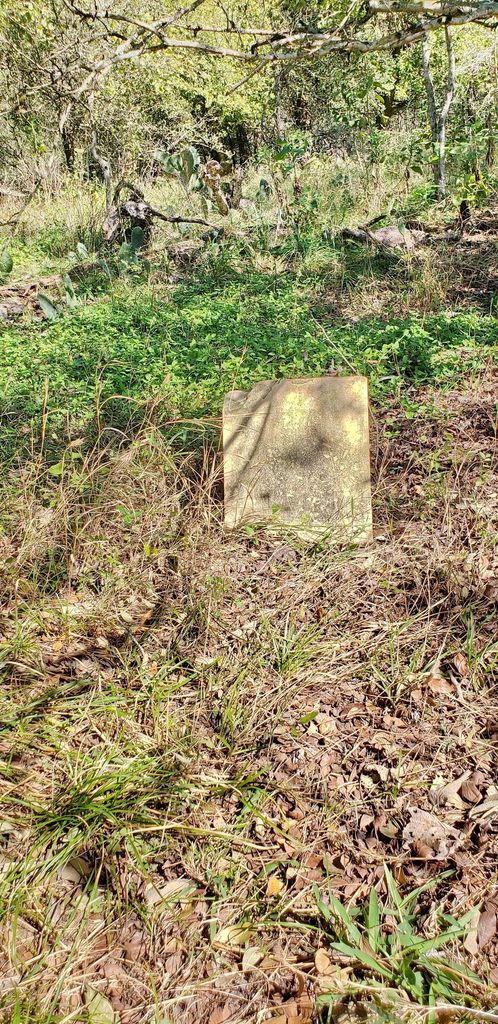
The cemetery is now disused for decades and overgrown by the surrounding wooded pastureland. There is no sign or fence to mark the cemetery nor any road or path to it. Many of the markers are no more than standing field stones or unengraved tiles scattered among the trees and bushes. There is a cluster of markers with names and dates ranging from cement ones with names drawn in, to a four-foot tall stamped concrete marker, to a military marker of engraved white marble, half-sunk into the ground.
This disused African-American cemetery is located at the top of a small rise above the fields in the fertile Colorado River bottomland. This small rise of rough land unsuitable for row cropping is currently called Barton Hill but in the past was the site of a community known as Union Hill. From the late nineteenth century to the late twentieth century a Barton family of farmers owned not only this the site of the cemetery but much of the land between current day FM 969 and Wilbarger creek to the north and the top of the hill and the Colorado River to the east. Prior to the mechanization of agriculture, owners of large tracts of farm lands would rent portions of the land out to tenant farmers for shares of the crop. With the exception of one WW 1 veteran whose ties to the others in the cemetery are not apparent, all of the persons known to be buried in Barton Cemetery are members of a large extended family, most of whom lived, worked, or both, on the Barton farm as a tenant farmer or a member of the family of a tenant farmer. Early USGS maps show clusters of buildings, many of them likely simple houses for tenant farmers atop the rise above fields on the Barton farm at a point where a road once crossed. Census records reflect that some of the persons buried in the cemetery were close neighbors of the Barton family at some time.
The cemetery is now disused for decades and overgrown by the surrounding wooded pastureland. There is no sign or fence to mark the cemetery nor any road or path to it. Many of the markers are no more than standing field stones or unengraved tiles scattered among the trees and bushes. There is a cluster of markers with names and dates ranging from cement ones with names drawn in, to a four-foot tall stamped concrete marker, to a military marker of engraved white marble, half-sunk into the ground.
Nearby cemeteries


- Added: 16 Jul 2018
- Find a Grave Cemetery ID: 2669288

Cemetery Photos
This is a carousel with slides. Use Next and Previous buttons to navigate, or jump to a slide with the slide dots. Use Escape keyboard button or the Close button to close the carousel.

Success
Uploading...
Waiting...
Failed
This photo was not uploaded because this cemetery already has 20 photos
This photo was not uploaded because you have already uploaded 5 photos to this cemetery
This photo was not uploaded because you have already uploaded 5 photos to this cemetery
Invalid File Type
Birth and death years unknown.
1 photo picked...
2 photos picked...
Uploading 1 Photo
Uploading 2 Photos
1 Photo Uploaded
2 Photos Uploaded
This photo is larger than 20 MB. Please resize to less than 20 MB and try again.
Too many photos have been uploaded
"Unsupported file type"
• ##count## of 0 memorials with GPS displayed. Double click on map to view more.No cemeteries found