Server error occurred while getting memorial plots. Some memorials may not be displayed.
Define the borders. Select along the edges to add as many corners as you need for the cemetery or section. To finish your outline, select the first point you created to close the shape.
- Coordinates: Get directions
- 39.96670
-111.30890 - Total memorials added:
- 49
- Memorials with GPS:
- 48
- Without grave photo -
Tip: Hold down the shift key and drag the mouse to select multiple memorials in a section of the cemetery.
More TipsWe’ve suggested a boundary based on the map. Does this look correct?
- Added: 1 Jan 2000
- Find a Grave Cemetery ID: 77334

Add Photos
- Photos larger than 8.0 MB will be reduced.
- Photos larger than 20 MB will not be accepted.
- Each contributor can upload a maximum of 5 photos for a cemetery.
- A cemetery can have a maximum of 20 photos.
- No AI-generated or digitally created images.
File Name ·
Cemetery Photos
This is a carousel with slides. Use Next and Previous buttons to navigate, or jump to a slide with the slide dots. Use Escape keyboard button or the Close button to close the carousel.
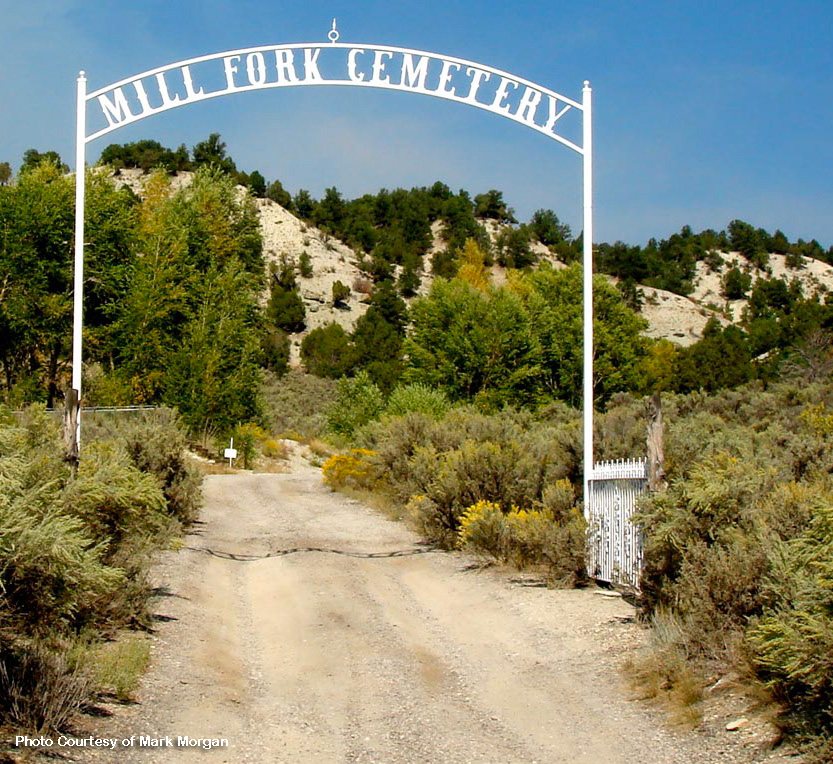
MILL FORK, UTAH
As one looks upon Mill Fork today it is had to visualize it as it was before the turn of the century. There were three saw mills in Mill Fork Canyon. Here ties were cut out of spruce, pine of whatever was available. It helped supply ties to the Rio Grande Railroad and two branch lines. Also the lumber was used to build homes here at Mill Fork, and up and down the canyon.
There were three charcoal kilns located along the highway just west of this cemetery. Men with teams and wagons cut pinion pine to burn in this kiln. One can walk for miles on the north side of the highway from Sheep Creek to Tie Fork and count thousands of pinion pine stumps left standing.
My mother, Hannah Chadwick Atwood told me many times of the upper charcoal kilns about three or four miles east of here, near Garner Hollow. Father lived about one-half mile east of this cemetery along the side of the hill. I had two brothers born here.
Many homes were built here in its early life. Some were located across the river to the south on the large flat. Others were built back in some of the side canyons. Some were rock dug-outs.
There was a general store and four section housed for the railroad employees. In 1888 a large water tank was built along the tracks. There was a reservoir located about three-fourth to one-half mile up Mill Fork Canyon that fed the tanks with gravity flow water. As a young man, I worked on this section and had to help maintain the reservoir.
There were farms along the river where there was a level spot. Beautiful potatoes were grown up here, also hay and grain. Men worked on the section for the charcoal kiln and other means to make a living.
Mother said they had dances held in the school house between here and Sheep Creek to the west. A cousin of mine burned it down so he wouldn't have to go to school. Mother said they made their own fun visiting each other, and with house socials. About two hundred fifty people lived here and around Mill Forks at its peak.
When I was a small boy I lived at Old Tucker. A school bus, driven by Merther Davis, picked up the children along the highway. In 1930-1935 there was at least twenty-five children riding this bus. Some were picked up here at Mill Fork to go to school at Thistle and Spanish Fork.
Volunteer for cemetery
Unvolunteer from cemetery
Spreadsheet Upload - Disabled
The spreadsheet upload feature is disabled during this preview version of Find a Grave. To upload a spreadsheet, please use the old site.