Server error occurred while getting memorial plots. Some memorials may not be displayed.
Define the borders. Select along the edges to add as many corners as you need for the cemetery or section. To finish your outline, select the first point you created to close the shape.
- Coordinates: Get directions
- 41.35511
-85.04953 - Total memorials added:
- 9,435
- Memorials with GPS:
- 7,257
- Without grave photo -
Tip: Hold down the shift key and drag the mouse to select multiple memorials in a section of the cemetery.
More TipsWe’ve suggested a boundary based on the map. Does this look correct?
- Added: 1 Jan 2000
- Find a Grave Cemetery ID: 87452

Add Photos
- Photos larger than 8.0 MB will be reduced.
- Photos larger than 20 MB will not be accepted.
- Each contributor can upload a maximum of 5 photos for a cemetery.
- A cemetery can have a maximum of 20 photos.
- No AI-generated or digitally created images.
File Name ·
Cemetery Photos
This is a carousel with slides. Use Next and Previous buttons to navigate, or jump to a slide with the slide dots. Use Escape keyboard button or the Close button to close the carousel.
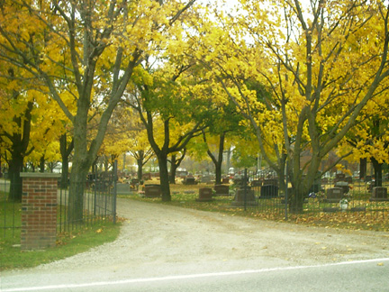
This public cemetery is located in the town of Auburn on the corner of Center St./CR39 and CR48. From SR8/Seventh St, east of CR427/Main St. go south on Center St. Roselawn, Woodlawn, and Southlawn look like one large cemetery. Roselawn is on the north end, Woodlawn is in the middle, and Southlawn is on the south end.
History:
From the 1920 History of Northeast Indiana, p. 584
Among the notable features of Auburn are Woodlawn and Evergreen Cemeteries and Eckhart Park. The former cemetery occupies the site of the old Peter Shafer farm, southeast of the city the property belonged to the Peter Shafer heirs, represented by Henry Shafer, a lawyer. He had the ground platted, the lots offered for sale, and a beautiful cemetery has been since developed from the land….
From "History of DeKalb County Cemeteries" by Dorothy A. Ditmars, April 18, 1924.
Sometime in 1888 or 1890, the Woodlawn Cemetery was laid out by Henry Shaffer. It is a part of the Peter Shaffer farm, and lies on the west side of the St. Joe road. It was marked out and surveyed by Mr. C. Van Auken, directed by Henry Shaffer. It has so rapidly filled up that additions had to be made and in 1923 burials were made on the north side of it. This land was owned by Mr. Abel.
Volunteer for cemetery
Unvolunteer from cemetery
Spreadsheet Upload - Disabled
The spreadsheet upload feature is disabled during this preview version of Find a Grave. To upload a spreadsheet, please use the old site.